Infrastructure

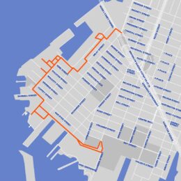
Map of Red Hook Coastal Resiliency Project, via nyc.gov.

Red Hook Coastal Resiliency Project Breaks Ground In Red Hook, Brooklyn

The City of New York has broken ground on the Red Hook Coastal Resiliency project, a $218 million initiative to bolster flood protection infrastructure in Red Hook, Brooklyn. Spearheaded by Mayor Eric Adams and led by the New York City Department of Environmental Protection, the project will install 2 miles of flood walls, flood gates, and redesigned streetscapes to mitigate the risk of future storm surges. Construction is expected to conclude by summer 2028.
Read More

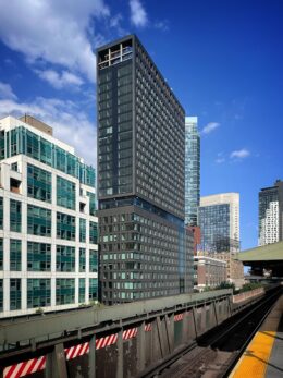
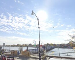
Ocean Avenue Pedestrian Bridge, via Google Maps

NYC DOT Completes Rehabilitation Of Ocean Avenue Pedestrian Bridge In Sheepshead Bay, Brooklyn

The New York City Department of Transportation (NYC DOT) has completed rehabilitation work on the historic Ocean Avenue Pedestrian Bridge, which connects the Brooklyn neighborhoods of Sheepshead Bay and Manhattan Beach. Originally constructed in 1880 and rebuilt in 1930, the 400-foot wooden span runs across Sheepshead Bay from Emmons Avenue to Shore Boulevard. The NYC DOT carried out the project using in-house construction teams, with funding provided by the agency and former State Assemblymember Steven Cymbrowitz.

Read More

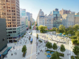
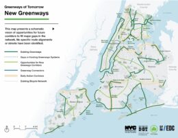
Rendering of new greenways. Source: Greater Greenways Plan

City Unveils Greater Greenways Plan To Expand NYC’s Parks And Waterfront Access

The City of New York has released the Greater Greenways plan, a blueprint to expand and unify the city’s multi-use corridors designed for cycling, walking, and recreation. Announced along the East River esplanade in Manhattan, the plan is a collaboration between the New York City Department of Transportation (NYC DOT), NYC Parks, and the Economic Development Corporation (EDC).

Read More

Illustration of Hillside Avenue and 150th Street, via jamaicaplan.nyc

City Planning Commission Approves Jamaica Neighborhood Plan In Queens

The New York City Planning Commission has approved the Jamaica Neighborhood Plan, a rezoning initiative aimed at transforming 230 blocks of Jamaica, Queens. Led by Mayor Eric Adams and the NYC Department of City Planning, the plan is expected to create over 12,000 new homes, including 4,000 permanently affordable units, along with 7,000 new jobs and more than 2 million square feet of commercial and community space. The plan will now advance to the City Council for final review after two years of development with extensive community engagement.

Read More

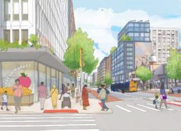
Rendering of Midtown South Mixed-Use Plan, via nyc.gov

City Council Land Use Committees Approve Midtown South Mixed-Use Plan

On August 6, the City Council’s Subcommittee on Zoning and Franchises and Committee on Land Use voted to approve the Midtown South Mixed-Use Plan, a major rezoning in Midtown, Manhattan that will allow for the creation of more than 9,500 new homes, including over 2,800 permanently affordable units. The initiative is the city’s largest residential rezoning in two decades. Developed as part of the city’s broader housing strategy, the plan introduces Mandatory Inclusionary Housing to Midtown South for the first time and includes a $488 million package of community and infrastructure investments.

Read More

Fetching more...