
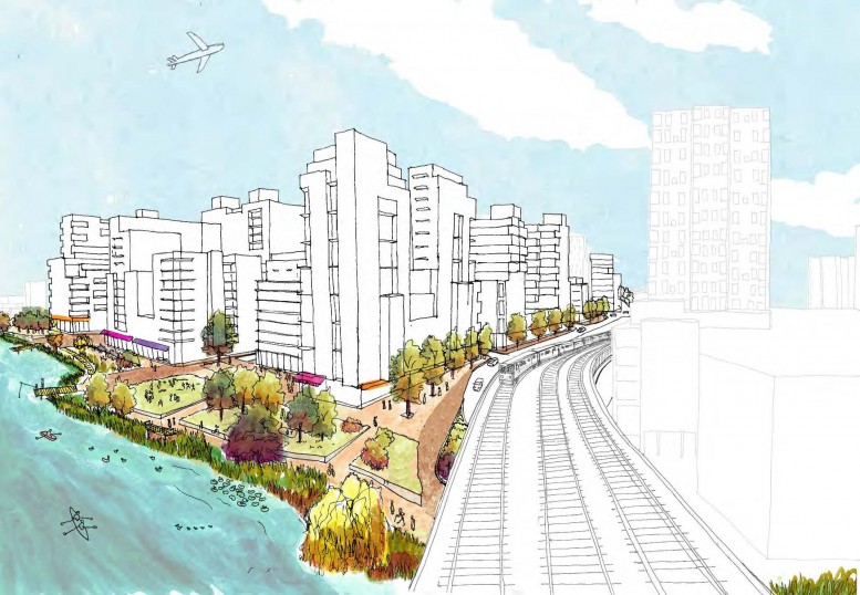
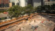
The polluted waterfront blocks in eastern Queens known as Flushing West are an industrial wasteland: vacant lots, warehouses, a scrap metal business, a lumber yard, a U-Haul rental. But the city hosted a meeting Wednesday night laying out its plan to rezone the 10-block swath along Flushing Creek and revitalize the area with new residential development.
Some industrial uses will be preserved, simply because certain landlords, like the U-Haul franchise owner, don’t plan to sell their property to residential developers anytime soon. Meanwhile, most of the area’s C4-2 commercial zoning will be upped to C4-4A. Although the current zoning allows residential and commercial projects, planners argue that it doesn’t create buildings that engage well with the street or pedestrians.
If the 10 blocks in the rezoning area were developed today, the new buildings would have block-covering bases with huge parking garages, topped by squat residential towers. And so far, it’s created more hotels than residential projects, because current zoning requires far less parking for hotels than for apartments.
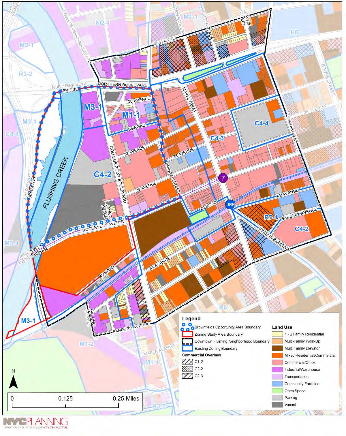
Current zoning in Flushing West, map via DCP
A small swath next to the manufacturing zone will become a mixed-use district, much like Long Island City. That two-block piece could have light industrial and commercial uses, along with apartment buildings of up to 80 feet.
But the defining piece of the city’s plan is the creation of a special waterfront district. It would require developers along Flushing Creek to create a waterfront promenade that’s at least 40 feet wide. The district may also require builders to include active uses on the ground floor, particularly along the waterfront. Planners want to encourage bars, restaurants, small shops, and community uses that go beyond medical offices, like daycares and senior centers.
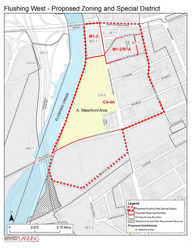
Planned rezoning for Flushing West, map via DCP
As part of the city’s push to create a more accessible public waterfront, developers will have to build new, private roads between College Point Boulevard and Flushing Creek. The new roads will also limit the width of new buildings, and the smaller ground floor retail spaces will hopefully encourage mom-and-pop businesses instead of big, national chains.
“It’s hard to limit the size and nature of commercial establishments,” explained Department of City Planning official Kiyoshi Yamazaki during Wednesday’s meeting. “But limiting the size of the base of the buildings and requiring new street would make it less attractive to big box retailers.”
The special district would also cap heights between 10 and 14 stories, because Flushing West sits directly in the flight path to LaGuardia Airport. Developers who want to build taller will have to get a special permit from the Board of Standards and Appeals, and furnish documentation from the Federal Aviation Administration that the extra height won’t interfere with the planes. Even then, builders could probably only get three or four extra stories on top of the maximum heights.

Proposed height caps for Flushing West, map via DCP
The rezoning could give Flushing another huge asset: a new bus terminal. Tom Smith, the director of studies for DCP’s Queens office, said that the city wants to build the bus transit center within a quarter mile of the Main Street stop on the 7 train. But it hasn’t found a specific site yet.
Ideally, a developer would build the station at the base of a mixed-use development. In exchange, the city would give the builder a zoning bonus—extra floor area. The outlines of the proposal are still pretty hazy, and we don’t know how heavily the city would subsidize the new bus station complex.
The goal is to reduce congestion in Flushing’s incredibly packed downtown, which fills with thousands of commuters getting off the 7 train and the LIRR at Main Street and Roosevelt Avenue during rush hour. More than 20 bus routes run through downtown Flushing, and the terminal would give passengers a place to wait and help keep buses from idling in the busiest part of the neighborhood.
And every new development will be subject to Mayor de Blasio’s mandatory inclusionary housing program, which requires builders to set aside 25 to 30 percent of their rentals as affordable housing. Developers will be able to apply for one of two options for including affordable units:
- Rent 25% of residential floor area at 60% of the city’s Area Median Income, or $46,620 for a family of three.
- Rent 30% of residential floor area at 80% of Area Median Income, which is $62,150 for a family of three.
However, the City Planning Commission and the City Council will have the final say in which subsidy option developers use.
And with any luck, the new buildings and waterfront promenade will coincide with the state and city’s cleanup of Flushing Creek, which has been polluted by manufacturing and sewage overflow for decades. The Department of Environmental Protection hopes to begin dredging the bottom of the creek sometime next year and aims to finish in 2019.
The Department of City Planning will post its presentation and scoping documents for the Flushing West rezoning next week. The new zoning will likely enter the public review process in the spring of 2016.
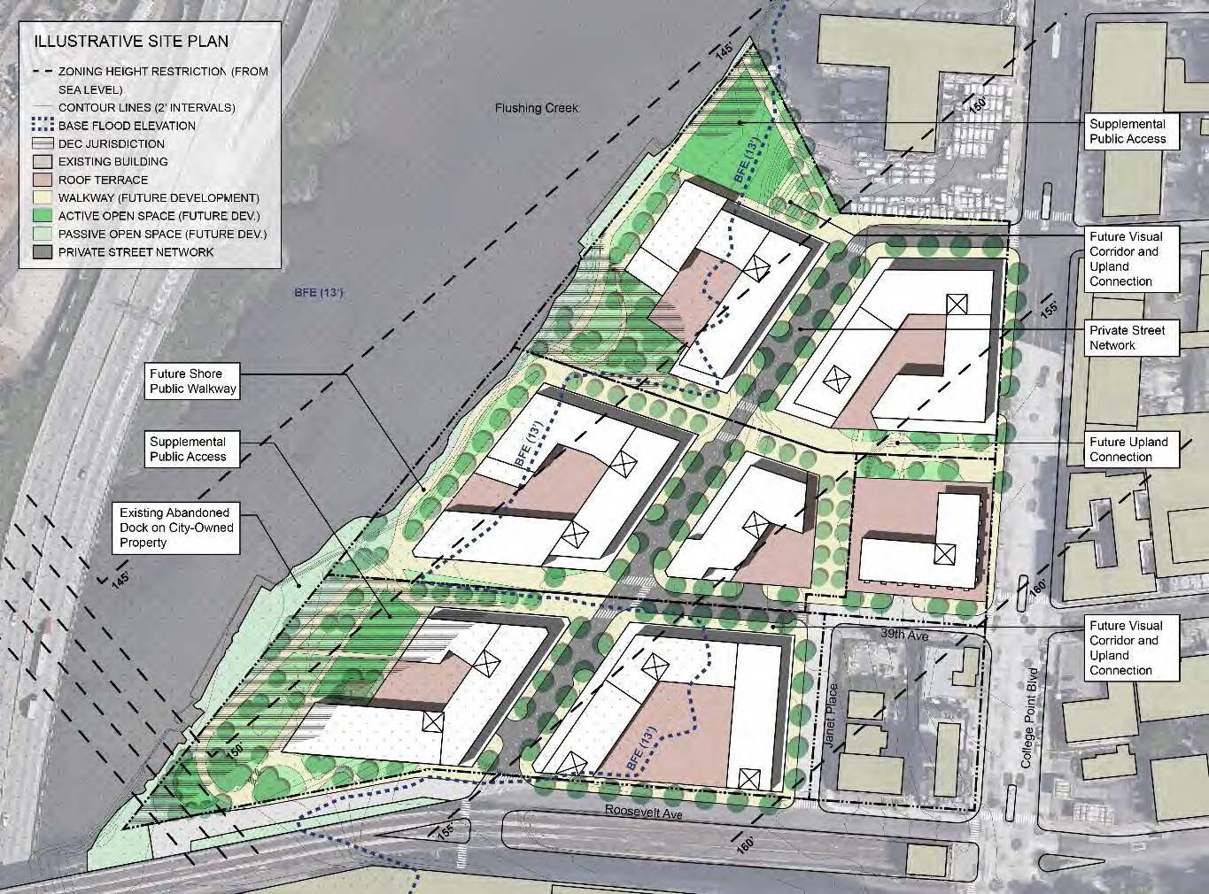
Potential site plan for Flushing West, image via DCP
Subscribe to YIMBY’s daily e-mail
![]()
Follow YIMBYgram for real-time photo updates
Like YIMBY on Facebook
Follow YIMBY’s Twitter for the latest in YIMBYnews
It would be great if the design supported community activities, programming, and meaningful access to the creek. Its just a matter of time before some community members will want to help with the stewardship and activation of pubic space.