
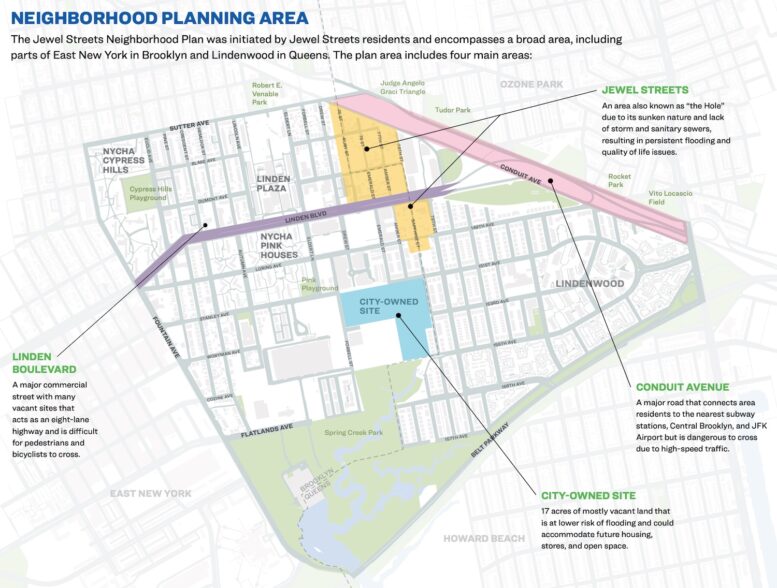
New York City Mayor Eric Adams has announced an infrastructure and housing initiative for the Jewel Streets neighborhood, spanning East New York in Brooklyn and Lindenwood in Queens. The Jewel Streets Neighborhood Plan follows more than two years of community engagement and will bring over $146 million in public investment. The plan includes a full drainage overhaul to address chronic flooding, traffic safety upgrades along Linden Boulevard, and a large-scale rezoning to support new housing. The project is being spearheaded by multiple agencies including NYC DEP, DOT, and DDC, with the city set to begin implementation immediately.
Central to the plan is the transformation of 17 acres of city-owned land into 1,400 new affordable and mixed-income homes. An additional 3,600 units are expected through a comprehensive rezoning process that will allow for new multifamily housing and retail development. The city will also restore the local street grid, incorporate green infrastructure, and introduce new community and retail spaces. Environmental review for the rezoning is expected to begin with a scoping hearing by the end of 2025, followed by the ULURP public review process in 2026.
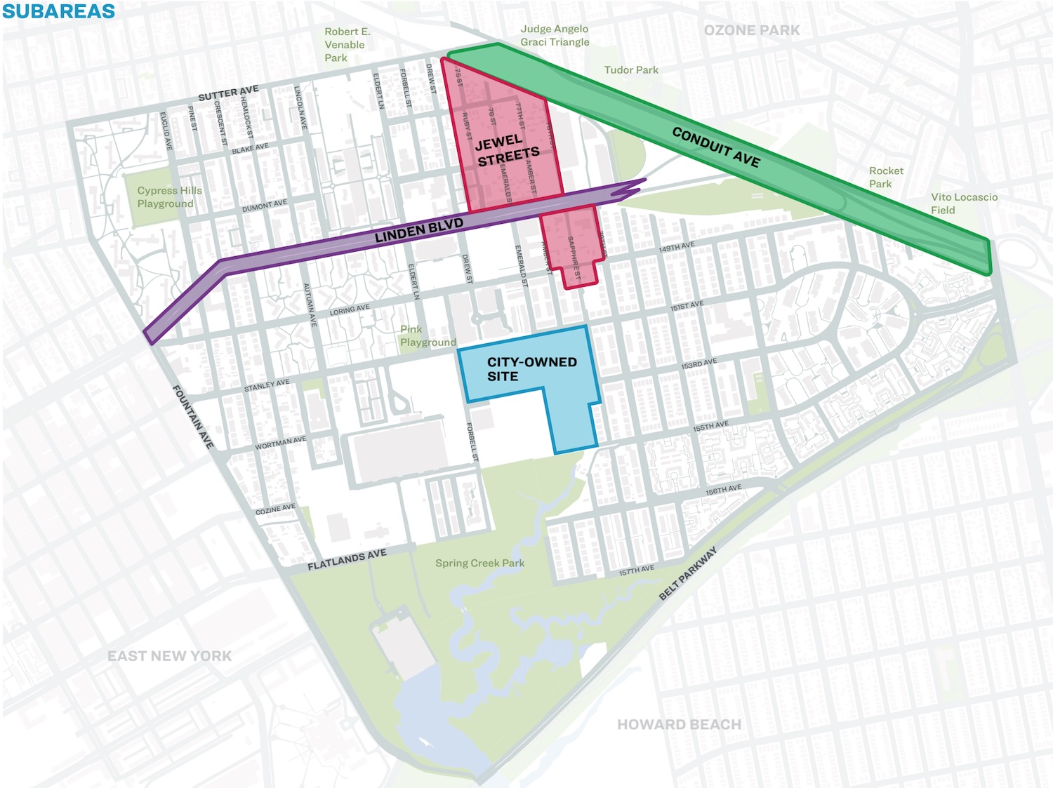
Subareas of the neighborhood plan, via nyc.gov.
To address the neighborhood’s longstanding drainage issues, the city will install new sanitary sewers, a stormwater and sanitary pump station, and a bluebelt system that includes new ponds and open space. Street reconstruction will add sidewalks, street trees, and pedestrian safety improvements. Along Linden Boulevard, the DOT will implement corridor-wide upgrades in 2026, including intersection redesigns, bus lane enhancements, and protections for cyclists and pedestrians.
“For too long the residents of the Jewel Streets have waited to see real change in their neighborhood,” said Jeff Roth, Deputy Mayor for Operations. “The new Jewel Streets Neighborhood Plan lays out a long-term, all-inclusive strategy to deliver the infrastructure and investment this community deserves, creating a safer, stronger, and more resilient neighborhood for current and future residents.”
Subscribe to YIMBY’s daily e-mail

Follow YIMBYgram for real-time photo updates
Like YIMBY on Facebook
Follow YIMBY’s Twitter for the latest in YIMBYnews
Great news. Curiously this post leaves out a few facts that every other article about the area usually starts with. It’s called The Hole, because part of the neighborhood is below sea level and floods even when there are no major weather events. It would have been helpful to include an elevation map so we can see how the city-owned site fares in that regard.
Similarly, how much good will any infrastructure improvement do unless the elevation is significantly increased?
To be fair, if they elevate the Hole, the area around it that is not elevated will become a moat. Better to get people out of it to safer, higher ground, and give it back to nature as a sponge park to absorb storm when we really need it.
I’m saddened that there’s no ambition to include an extension of the C train to a new terminal at Linden Boulevard and Eldert Lane through the Pitkin Yard. It would be fairly cheap to build since the tracks are there and an island platform could take the place of one existing yard track. It would be a game changer for this neighborhood if paired with increased C frequencies.
“Fairly cheap to build” … famous last words.
A revenue service run through a byzantine collection of non-revenue slow speed switches and curves is improper to say the least and TA would never go for it, even if it seemed “relatively” affordible. It’s incorrect transit planning for lack of a better term. In order to do it right you’d have to basically excavate a pair of running tunnels directly east of the Euclid station to bypass the active and congested storage yard entirely, and needless to say that could easily creep close to a billion dollar investment.
Aside from some pretty out-there by comparison ideas I have that I won’t get into, IMO the most reasonable concept to get subway service into this area lies in extending the New Lots Line to Fountain Av turning south with a station at Loring and terminating at Flatlands. Existing concepts to run trains through Linden Yard and then down to the current Gateway Center (which could see a massive redevelopment eventually) has the same flaw as the aforementioned running through of Pitkin Yard. Both (3) and express (4) trains could service the line to New Lots Av and Flatlands Av respectively.
Awesome more crappily constructed cookie cutter housing in the hinterlands.. limited and terrible at that transit in the area, few amenities or even basics like grocery .. just great mayor 2 step..
“Mayor” Adams is doing Nothing. And where is the money coming from? Without Federal and State money, the City has no money for anything new.